| “해남 지하 단층성 지진 확인”…활성단층 여부는 2027년부터 정밀 조사 2020년 76차례 이어진 지진, 2026년 인접 지역서 다시 발생 ai호남뉴스 박충배 편집/논설 aihnnewsr@kakao.com |
| 2026년 09월 28일(월) 12:40 |
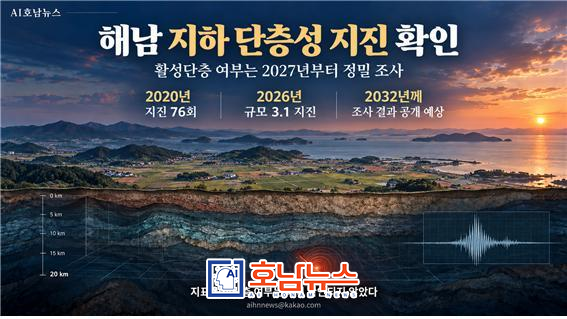 해남지하 단층성 지진 확인 / 사진제공=ai이미지 |
해남 지하에서 2020년에 이어 올해도 연속 지진이 관측되면서, 지진을 일으킨 심부 단층과 지표 단층의 관계를 밝히기 위한 조사에 관심이 쏠리고 있다. 지하 단층성 지진이 발생한 사실은 확인됐지만, 특정 지표 단층이 최근 지질시대에도 움직인 ‘활성단층’인지는 아직 확정되지 않았다.
기상청에 따르면 해남에서는 2020년 4월 26일부터 약 한 달 반 동안 작은 지진 76회가 발생했다. 같은 해 5월 3일 발생한 규모 3.1 지진의 진원 깊이는 21㎞로 발표됐다. 올해도 8월 14일부터 인접 지역에서 지진이 이어졌으며, 8월 23일에는 규모 3.1 지진이 발생했다.
기상청 전문가 분석에서는 2020년과 2026년 지진이 각각 약 500m×300m의 좁은 범위에 모여 발생했지만, 두 시기의 진원 분포는 다소 떨어져 있는 것으로 나타났다. 기상청은 8월 말 지진 발생 횟수가 감소하는 추세라고 평가하면서도, 진앙 부근에 지진계를 추가 설치해 미소지진을 정밀 관측하고 장기간 발생 추이를 살펴야 한다고 밝혔다.
한국지질자원연구원은 2020년 지진을 분석해 서북서–동남동 방향 심부 단층이 수평으로 엇갈려 움직이면서 발생한 것으로 해석했다. 연구원은 지진파 분석과 현장 조사에서 비슷한 방향의 중·소규모 단층군을 확인했다. 다만 당시 조사에서는 이 지진원 단층과 인근 광주단층을 비롯한 대규모 단층대의 관련성이 적다고 평가했다. 해남의 연속 지진을 곧바로 ‘광주단층 지진’으로 단정해서는 안 되는 이유다.
올해 발생한 지진이 2020년 지진과 어떻게 연결되는지도 연구 과제로 남아 있다. 지질자원연구원은 두 시기 지진이 발생한 인접 단층 사이에 응력 변화나 상호작용이 있었는지 살펴볼 계획이라고 밝혔다. 6년의 간격을 두고 지진이 관측됐다는 사실만으로 ‘6년 주기 지진’이라고 판단할 근거는 없다.
정부의 활성단층지도 제작 조사는 내년부터 전남광주 지역에서도 본격화될 예정이다. 27일 목포MBC 보도에 따르면 전남 지역의 첫 조사 대상으로 해남이 거론됐으며, 항공 레이저 측량과 현장 조사, 굴착 조사, 자료 분석을 거쳐 2032년쯤 결과가 공개될 것으로 예상된다. 이 시점은 보도에서 제시한 예상 일정으로, 현재 활성단층이 확인됐다는 뜻은 아니다.
조사의 관건은 지표 아래 지층에 실제로 단층 운동의 흔적이 남아 있는지, 그 움직임이 언제 일어났는지 확인하는 일이다. 연구진은 지형의 어긋남을 살핀 뒤 적절한 지점을 굴착해 끊기거나 밀린 지층을 조사하고 연대를 측정한다. 그러나 필요한 지점이 사유지에 있어 토지 소유자의 동의를 얻지 못하면 정밀조사가 어려워질 수 있다. 대체 조사 지점에서도 증거를 확보하지 못한 구간은 활성단층 여부가 ‘미확정’으로 남을 가능성이 있다. 미확정은 단층이 없다는 판정과 다르다.
활성단층 조사 결과와 별개로, 해남의 주요 시설은 이미 확보된 지진 관측 자료를 안전성 평가에 반영할 필요가 있다. 시설의 지진 위험은 단층과의 거리만으로 결정되지 않는다. 예상되는 흔들림의 크기와 진원 깊이, 부지의 토양·암반 특성, 시설의 내진설계 등을 함께 검토해야 한다.
해남에서 지금 확인된 것은 지하 단층성 지진의 발생이다. 앞으로의 조사는 지표에서 활성단층의 증거가 확인되는지, 확인된다면 어디에 분포하고 언제 움직였는지를 밝히는 과정이다. 조사 과정에서 사유지 접근이 어려운 구간을 어떻게 검증할지, 주요 시설의 부지별 안전성 평가에 관측 결과를 어떻게 반영할지가 핵심 과제로 떠올랐다.
“Earthquakes Linked to a Subsurface Fault Confirmed in Haenam”…Detailed Study of Surface Fault Activity to Begin in 2027
Seventy-six earthquakes recorded in 2020; tremors returned to a nearby area in 2026
Korea Meteorological Administration finds a difference between the two earthquake clusters and calls for further monitoring
Whether a surface fault has moved in recent geological time remains unconfirmed; access to private land could affect excavation work
Results expected around 2032; major facilities need site-specific seismic risk assessments
[Haenam=AI Honam News] aihnnews@kakao.com
A series of earthquakes beneath Haenam in 2020 and again this year has drawn attention to the relationship between the fault that caused the earthquakes deep underground and faults visible near the surface. Earthquakes associated with a subsurface fault have been confirmed. However, researchers have not established whether any particular surface fault moved in recent geological time and qualifies as an active fault.
According to the Korea Meteorological Administration (KMA), 76 small earthquakes occurred in Haenam over approximately six weeks beginning April 26, 2020. The agency reported that a magnitude 3.1 earthquake on May 3 that year originated at a depth of 21 kilometers. Earthquakes resumed in a nearby area on August 14 this year, followed by another magnitude 3.1 earthquake on August 23.
KMA experts found that the earthquakes in each period were concentrated within a small area measuring approximately 500 by 300 meters, although the 2020 and 2026 clusters were somewhat separated. The agency assessed in late August that the number of earthquakes was declining, while calling for additional seismometers near the epicenters to detect very small earthquakes and monitor activity over the long term.
After analyzing the 2020 earthquakes, the Korea Institute of Geoscience and Mineral Resources (KIGAM) concluded that they were caused by horizontal movement along a deep fault running west-northwest to east-southeast. Its seismic analysis and fieldwork identified a group of small and medium-sized faults with a similar orientation. At the time, KIGAM assessed that the fault responsible for the earthquakes was unlikely to be closely related to larger fault zones in the area, including the Gwangju Fault. The Haenam earthquakes therefore should not be described as earthquakes on the Gwangju Fault without further evidence.
How this year’s earthquakes relate to those in 2020 remains under investigation. KIGAM plans to examine whether changes in stress or interactions occurred between the adjacent faults associated with the two earthquake clusters. The six-year interval between the observed episodes alone does not establish a recurring six-year earthquake cycle.
The government’s active fault mapping project is expected to begin full-scale fieldwork in the Jeonnam–Gwangju region next year. According to a September 27 report by Mokpo MBC, Haenam has been identified as the first area to be surveyed in Jeonnam. The work is expected to include airborne laser mapping, field surveys, excavation and data analysis, with results anticipated around 2032. That date is a reported estimate for releasing the findings; it does not mean an active fault has already been confirmed.
A central question is whether layers beneath the surface preserve evidence of fault movement and, if so, when that movement occurred. Researchers first look for displaced landforms, then excavate suitable sites to examine disturbed geological layers and determine their ages. If a suitable site lies on private land and its owner does not agree to excavation, a detailed investigation may be difficult. Where an alternative site also fails to provide sufficient evidence, the fault’s status may remain undetermined. An undetermined finding does not establish that no fault exists.
Major facilities in Haenam need to take the seismic observations already available into account when assessing safety. Seismic risk cannot be determined by distance from a fault alone. Assessments must also consider potential ground shaking, earthquake depth, local soil and bedrock conditions, and each facility’s earthquake-resistant design.
What has been established in Haenam is the occurrence of earthquakes associated with faults deep underground. The forthcoming investigation will seek to determine whether evidence of active faulting exists near the surface and, if so, where the faults lie and when they moved. Securing access to critical survey sites and applying the findings to site-specific safety assessments will be key tasks.
 ai호남뉴스 박충배 편집/논설 aihnnewsr@kakao.com